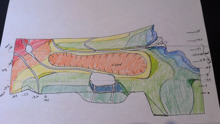
This is a rough elevation map of Falnorian. I haven’t included the key because it isn’t final; basically, cooler colors are closer to sea level/lower elevation, and warmer colors are higher elevation. Don’t mind all the numbers on the side – they refer to several other unrelated things and won’t help in deciphering the map.
So far as gradient goes, the distance between color gradients is closer for lower elevations (on the level of a few hundred feet at a time) and increase for higher elevations/warmer colors (on the level of a few thousand feet at at time).

1 thought on “Falnorian Elevation Map”
Comments are closed.